7017AIRPORT
AND AIRWAYS
7017AIRPORT
AND AIRWAYS
AMT111
PRELIM TOPICS
Is a term that refers to the design, development, production, operation, and use of aircraft, especially heavier-than-air aircraft.
Is a branch of science, business, or technology that deals with any part of the operation of machines that fly through the air.
THE AVIATION COMMUNITY
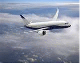
The aviation community has three sectors. The scheduled public air transportation to about 500 locations through the country and to every part of the globe is known as Commercial Aviation. The aircraft flown by the armed forces constitute Military Aviation. Any aeronautical activity that does not fail into one of these two sectors is called General Aviation.
Commercial aviation
Is the part of civil aviation (both general aviation and scheduled airline service) that involves operating aircraft for hire to transport passengers of cargo.
There are five major manufacturers of civil transport aircraft (in alphabetical order):
Airbus, based in Europe
Boeing, based in the United States
Bombardier, based in Canada
Embraer, based in Brazil
United Aircraft Corporation, based in Russia
Boeing, Airbus, llyushin and Tupolev concentrate on wide-body and narrow-body jet airliners, while Bombardier, Embraer and Sukhoi concentrate on regional airliners.
General Aviation
General aviation includes all non-scheduled civil flying, both private and commercial. General aviation may include business flights, air charter, private aviation, flight training, parachuting, aerial photography, foot-launched powered hang gliders, air ambulance, crop dusting, charter flights, traffic reporting, police air patrols and forest fire fighting.
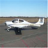
Many small aircraft manufacturers, including Cessna, Piper, Diamond, Mooney, Cirrus Design, Raytheon and others serve the general aviation market, with a focus on private aviation and fight training.
Military Aviation
Is the use of aircraft and other flying machines for the purposes of conducting or enabling warfare, including national airlift (cargo) capacity to provide logistical supply to forces stationed in a theater or along a front. The wide variety of military aircraft includes bombers, fighters, fighter bombers, transports, trainers, and reconnaissance aircraft. These varied types of aircraft allow for the completion of a wide variety of objectives.
Types of military aircraft
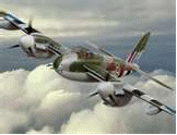
Fighter aircrafts - primary function is to destroy other aircraft. (e.g. Sopwith Camel, A6M Zero, F-15, MiG-29, Su-27, F-22).
Ground attack aircraft - are used against tactical earth-bound targets. (e.g. Junkers Stuka diver bomber, A-10 Warthog, llyushin II-2, J-22 Orao, and Sukhoi Su-25).
Bombers - are generally used against more strategic targets, such as factories and oil fields. (e.g. Zeppelin, B-29 Superfortress, Tu-95, Dassault Mirage IV, and the B-52 Stratoforstress).
Cargo transport - aircraft are used to transport hardware and personnel, such as the C-17 Globemaster III or C-130 Hercules.
Surveillance aircraft - are used for reconnaissance (e.g. Rumpler Taube, de Havilland Mosquito, U-2, and MiG-25R)
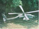
Helicopters - are used for assault support, cargo transport and close air support (e.g. AH-64, Mi24)
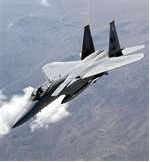

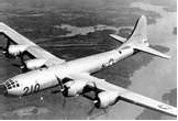
F-15 Sukhoi Su-25 B-29 Superfortress
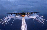
C-130 Hercules de Havilland Mosquito AH-64
CATEGORIES OF AN AIRCRAFT
Transport – refers to airlines and other large aircraft that exceed certain limit.
Commuters – aircraft design to carry passengers.
Restricted – aircraft used for special purpose.
Limited – refers to military aircraft that are now allowed to be used only for limited purpose in civil aviation.
Experimental – aircraft used to test new design and new concept.
Provisional – an interim measure which have not net all requirements for initial certification.
Aerobatic – aircraft which has the fewest operations because this design requirements demand more strength than others.
Normal and Utility – common to most airplanes used in fight training and certified for both of these categories.
AIRPLANE CLASSIFICATION
HEAVIER THAN AIR
HEAVIER THAN AIR AERODYNES
Including autogyros, helicopters and variants, and conventional fixed-wing aircraft: aeroplanes in Commonwealth English (excluding Canada), airplanes in North American English. Fixed-wing aircraft generally use an internal-combustion engine in the form of a piston engine (with a propeller) or a turbine engine (jet or turboprop), to provide thrust that moves the craft forward through the air. The movement of air over the airfoil produces lift that causes the aircraft to fly. Exceptions are gliders which have no engines and gain their thrust, initially, from winches or tugs and then from gravity and thermal currents. For a glider to maintain its forward speed it must descend in relation to the air (but not necessarily in relation to the ground). Helicopters and autogyros use a spinning rotor (a rotary wing) to provide both lift and thrust. The abbreviation VTOL is applied to aircraft other than helicopters that can take off or land vertically STOL stands for Short Take Off and landing.
LIGHTER THAN AIR
LIGHTER THAN AIR AEROSTATS
Including hot air balloons and airships. Aerostats use buoyancy to float in the air in much the same manner as ships float on the water. In particular, these aircraft use a relatively low density gas such as helium, hydrogen or heated air, to displace the air around the craft. The distinction between a balloon and an airship is that an airship has some means of controlling both its forward motion and steering itself, while balloons are carried along with the wind.
There are several ways to classify aircraft. Below, we describe classifications by design, propulsion and usage.
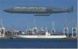
HEAVIER THAN AIR AIRCRAFT (B747) AND LIGHTER THAN AIR AIRCRAFT (AIRSHIP)
BY DESIGN
A first division by design among aircraft is between lighter-than-air, aerostat, and heavier-than-aircraft, aerodyne.
Examples of lighter-than-air aircraft include non-steerable balloons, such as hot air balloons and gas balloons, and airships (sometimes called dirigible balloons) such as blimps (that have non-rigid construction) and rigid airships that have a rigid frame. The most successful type of rigid airship was the Zeppelin, although there were some accidents such as the Hindenburg Zeppelin which was destroyed in a fire at Lakehurst, NJ, in 1937
In heavier-than-air aircraft. There are two ways to produce lift aerodynamic lift and engine lift. In the case of aerodynamic lift, the aircraft is kept in the air by wings or rotors. With engine lift, the aircraft defeats gravity by use of vertical thrust greater than its weight.
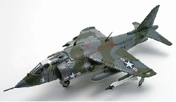
Examples of engine lift aircraft are rockets, and VTOL planes such as the Hawker-Siddeley Harrier (on left).
Among aerodynamically lifted aircraft, most fall in the category of fixed-wing aircraft, where horizontal airfoils produce lift.
In a “conventional” configuration, the lift surfaces are placed in front of a control surface of tailplane. The other configuration is the canard where small horizontal control surfaces are placed forward of the wings, near the nose of the aircraft. Canards are becoming more common as supersonic aerodynamics grows more mature and because the forward surface contributes lift during straight-and-level flight.
BY PROPULSION
 Some
types of aircraft, such as the balloon or glider, do not have any
propulsion. Balloons drift with the wind, though normally the pilot
can control the altitude either by heating the air or by releasing
ballast, giving some directional control (since the wind direction
changes with altitude). For gliders, takeoff takes place from a high
location, or the aircraft is pulled into the air by a ground-based
winch or vehicle, or towed aloft by a powered “tug” aircraft.
Airships combine a balloon’s buoyancy with some kind of
propulsion, usually propeller driven.
Some
types of aircraft, such as the balloon or glider, do not have any
propulsion. Balloons drift with the wind, though normally the pilot
can control the altitude either by heating the air or by releasing
ballast, giving some directional control (since the wind direction
changes with altitude). For gliders, takeoff takes place from a high
location, or the aircraft is pulled into the air by a ground-based
winch or vehicle, or towed aloft by a powered “tug” aircraft.
Airships combine a balloon’s buoyancy with some kind of
propulsion, usually propeller driven.
BY USAGE
The major distinction in aircraft usage is between military aviation, which includes all uses of airplane for military purposes (such as combat, patrolling, search and rescue, reconnaissance, transport, and training), and civil aviation, which includes all uses of airplanes for non-military purposes.
TYPES OF AIRCRAFT
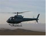
Helicopters
A helicopter is one of the most convenient and timesaving ways to transfer between the city and airport, alternatively an easy way to reach remote destinations.
Twin Pistons
A economical aircraft range suitable for short distance flights.
Aircraft seating capacity ranging from 3 to 8 passengers.
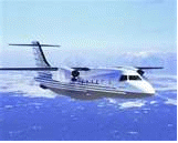
Turboprops
A wide range of aircraft suitable for short and medium distance flights with a duration of up to 2-4 hours. Aircraft seating capacity ranging from 4 to 70 passengers.
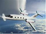
Executive Jets
An Executive Jet is the most time efficient way of travel, suitable for medium of long distance flights. Aircraft seating capacity ranging from 4 to 16 passengers.
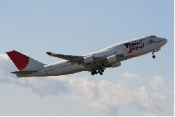
Airliners
Large jet aircraft suitable for all kinds of flights. Aircraft seating capacity ranging form 50 to 400 passengers.
Cargo Aircraft
Any type of cargo. Ranging from short notice flights carrying vital spare parts up to large cargo aircraft that can transport any voluminous goods.
IMPORTANT AERONAUTICAL TERMS
Aeroplane – A powered aircraft that derives its lift from the movement of air over fixed lifting surfaces.
Aerostat – A lighter-than-air craft, such as a balloon or airship. Its lift is caused by buoyancy relative to surrounding air.
Aircraft – A vehicle that can travel through the air.
Airplane – A powered aircraft that derives its lift from the movement of air over fixed lifting surfaces.
Airship – A lighter-than-air craft that can be steered and propelled through the air. (Also dirigible)
Autogyro – A rotor-craft with unpowered blades- it requires a separate engine to provide forward motion before lift is developed.
Balloon – An unpowered lighter-than-air craft.
Biplane – An aeroplane with two similar-sized wings (or pais of wings), exactly or approximately in vertical alignment.
Blimp – None-rigid airship.
Dirigible – A lighter-than-air craft that can be steered and propelled through the air. From the French word dirigeable meaning steerable.
Helicopter – A rotor craft with one or more sets of powered blades.
Monoplane – An aeroplane with one wing (or pairs of wings).
Rotocraft – An aircraft that derives its lift from rotating lifting surfaces (usually called blades)
Aircraft – Anything that is designed to be flown in the air. The general term aircraft includes airplanes, helicopters, gliders, airships, balloons and kites. Airplane and aircraft are not synonymous; airplanes are aircraft, but not all aircraft are airplanes.
Airfoil – any surface capable of producing lift. The wings are the primary airfoils of an airplane but the tail, propeller and fuselage produce lift as well. Thus, wings are airfoils but not all airfoils are wings; wing and airfoil are not synonymous.
Airplane – A mechanically or engine-driven, fixed wing, heavier-than-air craft that is supported in the air by lift. The term airplane (or aeroplane) frequently is shortened now to simply “plane.”
Airship – a lighter-than-air craft with a propelling system and a means of controlling the direction of flight (steering). Blimps are an example of airships.
Glider – A heavier-than-air aircraft that is supported in the air by lift and whose free flight does not depend on an engine.
Heavier-than-air – Aircraft, such as airplanes, gliders and helicopters, whose lift is produced by a reaction between airfoils and motion through the air. In the early days of aviation, powered heavier-than-air flight was also known as “mechanical” flight, since lift was generated “mechanically” by the movement of an airfoil through the air.
Lighter-than-air – Aircraft, such as balloons and airships, i.e., blimps, dirigibles, whose buoyancy for lifting capability depends on being inflated with a gas (such as hot air, hydrogen or helium) that is lighter than the air in which it is supported.
CAAP CIVIL AVIATION AUTHORITY OF THE PHILIPPINES
 The
Philippines’ Civil Aviation Authority formerly Air Transportation
Office (Filipino: Tanggapan ng Tranportasyong Himpapawid),
abbreviated as CAAP, is an agency of the Philippine government under
the Department of Transportation and Communications responsible for
implementing policies on civil aviation to assure safe, economic and
efficient air travel. The agency also investigates aviation
accidents. The agency’s main office is in Pasay City.
The
Philippines’ Civil Aviation Authority formerly Air Transportation
Office (Filipino: Tanggapan ng Tranportasyong Himpapawid),
abbreviated as CAAP, is an agency of the Philippine government under
the Department of Transportation and Communications responsible for
implementing policies on civil aviation to assure safe, economic and
efficient air travel. The agency also investigates aviation
accidents. The agency’s main office is in Pasay City.
CIVIL AERONOUTICS BOARD (PHILIPPINES)
The
Civil Aeronautics Board (CAB) is a government agency of the
Philippines tasked to regulate, promote and develop the economic
aspect of air
 transportation
in the Philippines and to ensure that existing CAB policies are
adapted to the present and future air commerce of the Philippines.
transportation
in the Philippines and to ensure that existing CAB policies are
adapted to the present and future air commerce of the Philippines.
The Board has supervisory and jurisdictional control over air carriers, general sales agents, cargo sales agents, and airfreight forwarders, as well as their property, property rights, equipment, facilities and franchises. It is attached to the Department of Transportation and Communications.
FIXED BASE OPERATOR
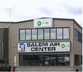 An
FBO or fixed base operator (also known as fixed of operation), is
the primary provider of services to general aviation aircraft and
operators located at or adjacent to an airport. An FBO may be a
private enterprise, municipality or city operated, or state-agency
operated. Primarily a term used within the United States and other
North American countries, the term is becoming more common in the
international aviation industry.
An
FBO or fixed base operator (also known as fixed of operation), is
the primary provider of services to general aviation aircraft and
operators located at or adjacent to an airport. An FBO may be a
private enterprise, municipality or city operated, or state-agency
operated. Primarily a term used within the United States and other
North American countries, the term is becoming more common in the
international aviation industry.
FBO businesses traditionally offer aircraft refueling (also known as line service) of both reciprocating engine aircraft fuel (100LL or Avgas) and turbine aircraft fuel (Jet-A or Jet A-1), aircraft parking and tie-down, and access to basic comforts such as restrooms and telephones. Other services may include flight training and aircraft rental, aircraft maintenance service, hangar storage, air charter and air-taxi, aircraft sales, and ground handling of passengers, baggage, and/or cargo.
FLIGHT SERVICE STATION
A Flight Service Station (FSS) is an air traffic facility that provides information and services to aircraft pilots before, during, and after flights, but unlike air traffic control (ATC), is not responsible for giving instruction or clearances or providing separation. The people who communicate with pilots from an FSS are referred to as specialists rather than controllers, although in the US, FSS specialists’ official job title is air traffic control specialist – station.
 The
precise services offered by stations vary by country, but typical
FSS services may include providing preflight briefings including
weather and notices to airmen (NOTAMs); filing, opening, and closing
flight plans; monitoring navigational aids (NAVAIDs); collecting and
disseminating pilot reports (PIREPs); offering traffic advisories to
aircraft on the ground or in flight; relaying instructions or
clearances from air traffic control; and providing assistance in an
emergency. In many countries, flight service stations also operate
at mandatory frequency airports to help co-ordinate traffic in the
absence of air traffic controllers, and may take over a control
tower frequency at a controlled airport when the tower is closed.
The
precise services offered by stations vary by country, but typical
FSS services may include providing preflight briefings including
weather and notices to airmen (NOTAMs); filing, opening, and closing
flight plans; monitoring navigational aids (NAVAIDs); collecting and
disseminating pilot reports (PIREPs); offering traffic advisories to
aircraft on the ground or in flight; relaying instructions or
clearances from air traffic control; and providing assistance in an
emergency. In many countries, flight service stations also operate
at mandatory frequency airports to help co-ordinate traffic in the
absence of air traffic controllers, and may take over a control
tower frequency at a controlled airport when the tower is closed.
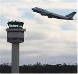
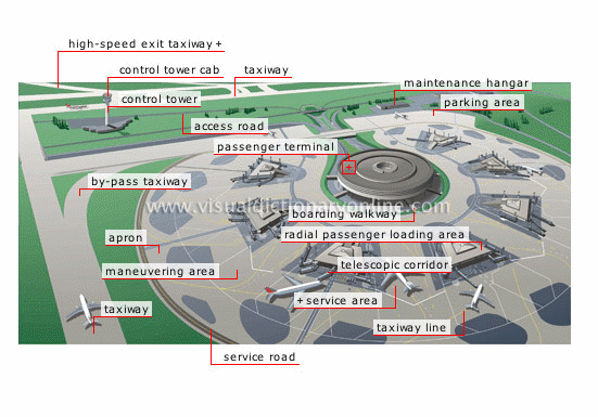
INTRODUCTION TO AIRPORT
AIRPORT
Is a location where aircraft such as fixed-wing aircraft, helicopters, and blimps takeoff and land. An Airport consists of at least one surface such as runway for a plane to take off and land, a helipad, or water for takeoffs and landings, and often includes buildings such as control towers, hangars and terminal buildings.
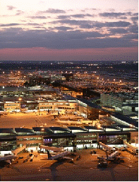
SEOUL INCHEON INTERNATIONAL AIRPORT
AIRSIDE AREAS
RUNWAY
Is a strip of land at an airport on which aircraft can take off and land and forms part of maneuvering area. Runways may be a man-made surface (often asphalt, concrete, or a mixture of both) or natural surface (grass, dirt, gravel, or salt)
TAXIWAY
A taxiway is a path on an airport connecting runways with ramps, hangars, terminals and other facilities. They mostly have a hard surface such as asphalt or concrete, although smaller airports sometimes use gravel or grass. Busy airports typically construct high-speed or rapid-exit taxiways in order to allow aircraft to lave the runway at higher speeds. This allows the aircraft to vacate the runway quicker, permitting another to land in a shorter space of time.
AIRPORT RAMP
The airport ramp or apron is a part of an airport. It is usually the area where the aircraft are parked, unloaded or loaded, refueled or boarded. Although the use of apron is covered by regulations, such as lighting on vehicles, it is typically more accessible to users than the runway or taxiway. However, the apron is not usually open to the general public and a license may be required to gain access.
AIRPORT RUNWAY, TAXIWAY AND APRON AREA
LANDSIDE AREAS
PARKING LOT
A parking lot (known as a car park in countries such as Malaysia, Australia, United Kingdom and Ireland), also known as car lot, is a cleared area that is more or less level and is intended for parking vehicles. Usually, the term refers to a dedicated area that has been provided with a durable or semi-durable surface. In most countries where cars are the dominant mode of transportation, parking lots are a feature of every city and suburban area. Shopping malls, sports stadiums, mega churches and similar venues often feature parking lot of immense area.
PUBLIC TRANSPORTATION
Public transport (also public transportation, public transit, or mass transit) comprises passenger transportation services which are available for use by the general public, as opposed to modes for private use such as automobiles or vehicles for hire. Public transport services are usually funded by fares charged to each passenger, with varying levels of subsidy from local or national tax revenue, full-subsidized, zero-fare services operate in some towns and cities.
ACCESS
ROAD
Access roads provide critical links between public-use airport facilities and the public roadway network serving the surrounding area. Public access roads on airport property provide access to public areas on an airport. Funding sources for access roads vary based on the location of the roads. The design and construction of access roads built within airport property boundaries are eligible for federal capital improvement funding and state funding through the Airport Capital Program.
PERIMETER ROADS
A perimeter road provides restricted access within an airport’s field. These perimeter roads are used by airport, and FAA staff to conduct business activities, such as security check and maintenance work, on an airport. Airport Capital Program funds may be used to design and construct perimeter roads.
SHOPS AND FOOD SERVICES
The prices charged for food are generally higher prices found outside the airport. However, some airports now regulate food costs to keep them comparable to “street prices”. This term is misleading as often match the manufacturer’s suggested retail price (MSRP) but are almost never discounted.
Some restaurants offer regional cuisine specialties for those in transit so that they may sample local food or culture without leaving the airport.
PREMIUM AND VIP SERVICES
Airports may also contain premium and VIP services. The premium and VIP services may include express check-in, dedicated check-in counters, separate departures and/or arrival lounge, priority boarding, separate air bridges, and priority baggage handling.
These services are usually reserved for First and Business class passengers, premium frequent flyers, and members of the airline clubs. Premium services may sometimes be open to passengers who are members of different airliners frequent flyer program. This can may sometimes be part of a reciprocal deal, as when multiple airlines are part of the same alliance, or as ploy to attract premium customers away from rival airlines.
SUPPORT SERVICES
Aircraft maintenance, pilot services, aircraft rental, and hangar rental are most often performed by fixed base operator (FBO). At major airports, particularly those used as hubs, airlines may operate their own support facilities.
AIRPORT ACCESS
Many large airports are located near railway trunk routes for seamless connection of multimodal transport. For instance, Frankfurt Airport, Amsterdam Airport Schiphol, London Heathrow Airport and London Stansted Airport. It is also common to connect an airport and a city with rapid transit, light rail lines or other non-road public transport systems. For instance, the Airtrain JFK at John F. Kennedy International Airport in New York and the Silver Line T at Boston’s Logan International Airport by Massachusetts Bay Transportation Authority (MBTA). Such connection lowers risk of missed flights due to traffic congestion. Large airports usually have access also through expressways from which vehicles enter either the departure loop or the arrival loop.
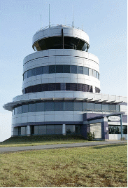
AIRPORT TERMINAL
AIRPORT TERMINAL
An airport terminal is a building at an airport where the passengers transfer between ground transportation and the facilities that allow them to board and disembark from aircraft. Within the terminal, passengers purchase tickets, transfer their luggage, and go through security. The buildings that provide access to the airplanes (via gates) are typically called concourses. Smaller airports have one terminal while the larger airports have several terminals and/or concourses. At smaller airports, the single terminal building typically serves all the functions of a terminal and a concourse.
AIRPORT TERMINAL DESIGN
Due to the rapid rise in popularity of passenger flight, many early terminals were built in the 1930s-1940s and reflect the popular art deco style architecture of the time. One such surviving example from 1940 is the Houston Municipal Airport Terminal. Early airport terminals opened directly onto the tarmac: passengers would walk or take a bus to their aircraft. This design is still common among smaller airports, and even many larger airports have “bus gates” to accommodate aircraft beyond the main terminal.
Typically design of a terminal, showing the Departures (upper half page) and Arrival levels.
Departures Lounge
Gates and jet bridge
Security Clearance Gates
Baggage Check-in
Baggage Carousels
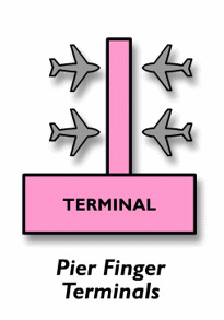
Pier
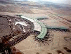
A pier design uses a long, narrow building with the aircraft parked on both sides. One end connects to a ticketing and baggage claim area. Piers offers high aircraft capacity and simplicity of design, but often result in a long distance from the check-in counter to the gate (up to half mile in the case of Kansai International Airport). Most large international airports have piers, including Chicago O’Hare International Airport, Frankfurt International Airport and London International Airport.

Satellite Terminal
A satellite terminal is a building detached from other airport buildings, so that aircraft can park around is entire circumferences. The first airport to use satellite terminal was London Gatwick Airport. It used an underground pedestrian tunnel to connect the satellite to the main terminal. This was also the first setup at Los Angeles International Airport, but it has since been converted into pier layout. The first airport to use an automatic people mover to connect the main terminal with a satellite was Tampa International Airport, which is the standard today. Paris’s Charles de Gaulle International Airport (Terminal 1) and London Gatwick Airport (South Terminal) both have circular satellite terminals, building via underground tunnels and walkways. Zurich Airport’s Gate E are connected by a subway. Sea-Tac International Airport has two rectangular satellite terminals connected by an automatic people mover.
Semicircular Terminal
Some airports use a semicircular terminal, with aircraft parked on one side and cars and cars on the other. This design results in long walks for connecting passengers, but greatly reduces travel times between check-in and the aircraft. Airports designed around this model include Charles de Gaulle International Airport (Terminal 2), Mumbai International Airport (Terminal 2), Dallas /Fort Worth International Airport, Seoul’s Incheon International Airport, Kansas City Airport and Sapporo’s New Chitose Airport.
KINDS OF AIRPORT
INTERNATIONAL AIRPORT
An international airport is an airport typically equipped with customs and immigration facilities to handle international flights to and from other countries. Such airports are usually larger, and often feature longer runways and facilities to accommodate the large aircraft commonly used for international or intercontinental travel. International airports often host domestic flights (flights which occur within the country) in addition to international flights. In smaller countries most airports are international airports, so the concept of an “international airport” has little meaning. In certain countries however, there is a sub-category of limited international airports which handle international flights, but are limited to short-haul destinations (often due to geographical factors) or are mixed civilian/military airports.
Many airports with regular scheduled international services have the word “international” in their official names, but others, including such major airports as London Heathrow Airport, Detroit Metropolitan Wayne county Airport, and George Bush Intercontinental Airport do not. Conversely, some airports which call themselves international airports, especially in smaller United States cities, in fact have no scheduled international flighyts. At many of these airports customs and immigration services are only available with several hours advance notice. One example of such an airport is Gerald R. Ford International Airport in Grand Rapids, Michigan. A few
A domestic airport is an airport which handles only domestic flights or flights within the same country. Domestic airports don't have customs and immigration facilities and are therefore incapable of handling flights to or from a foreign airport.
These airports normally have short runways which are sufficient to handle short/medium haul aircraft and regional air traffic.[citation needed] They have in many countries not had any security check / metal detector, but such checks have been added in recent years.
Most municipal airports in Canada and the United States are of this classification. At international airports in Canada, there are domestic terminals that handle flights within Canada (flying from one Canadian city to another).
Several small countries do not have any public domestic airports, or even public domestic flights, e.g. Belgium.
Airport guidance signs provide direction and information to taxiing aircraft and airport vehicles. Smaller airports may have few or no signs, relying instead on airport diagrams and charts.
There are two classes of signage at airports, with several types of each:
Operational guidance signs

Location sign for a taxiway.

Direction sign to taxiway Bravo.
Location signs – yellow on black background. Identifies the runway or taxiway currently on or entering.
Direction/Runway Exit signs – black on yellow. Identifies the intersecting taxiways the aircraft is approaching, with an arrow indicating the direction to turn.
Other – many airports use conventional traffic signs such as stop and yield signs throughout the airport.
Mandatory instruction signs


No entry sign.
Mandatory instruction signs are white on red. They show entrances to runways or critical areas. Vehicles and aircraft are required to stop at these signs until the control tower gives clearance to proceed.
Runway signs – White text on a red background. These signs simply identify a runway intersection ahead.
Frequency Change signs – Usually a stop sign and an instruction to change to another frequency. These signs are used at airports with different areas of ground control.
Holding Position signs – A single solid yellow bar across a taxiway indicates a position where ground control may require a stop. If two solid yellow bars and two dashed yellow bars are encountered, this indicates a holding position for a runway intersection ahead; runway holding lines must never be crossed without permission. At some airports, a line of red lights across a taxiway is used during low visibility operations to indicate holding positions. An "interrupted ladder" type marking with an "ILS" sign in white on red indicates a holding position before an ILS critical area.
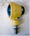
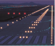
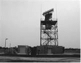
[edit] Lighting
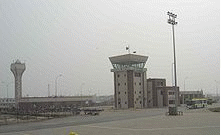
Flood lights in front of the control tower at Sialkot International Airport, Pakistan
Many airports have lighting that help guide planes using the runways and taxiways at night or in rain or fog.
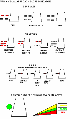
On runways, green lights indicate the beginning of the runway for landing, while red lights indicate the end of the runway. Runway edge lighting consists of white lights spaced out on both sides of the runway, indicating the edge. Some airports have more complicated lighting on the runways including lights that run down the centerline of the runway and lights that help indicate the approach (an Approach Lighting System, or ALS). Low-traffic airports may use Pilot Controlled Lighting to save electricity and staffing costs.
Along taxiways, blue lights indicate the taxiway's edge, and some airports have embedded green lights that indicate the centerline.
-
Used to mark hazards
Gives pilots a visual aid (usually creates a lane)
Meant to be visible to pilots and not a disturbance to people on ground
Weather observations
See also: Surface weather observation, Weather station, Automated airport weather station, and Automatic weather station
Weather observations at the airport are crucial to safe takeoffs and landings. In the US and Canada, the vast majority of airports, large and small, will either have some form of automated airport weather station, whether an AWOS, ASOS, or AWSS, a human observer or a combination of the two. These weather observations, predominantly in the METAR format, are available over the radio, through Automatic Terminal Information Service (ATIS), via the ATC or the Flight Service Station.
Planes take-off and land into the wind in order to achieve maximum performance. Because pilots need instantaneous information during landing, a windsock is also kept in view of the runway.
FAA
Our Mission
Our continuing mission is to provide the safest, most efficient aerospace system in the world.
Our Vision
We strive to reach the next level of safety, efficiency, environmental responsibility and global leadership. We are accountable to the American public and our stakeholders.
Our Values
Safety is our passion. We work so all air and space travelers arrive safely at their destinations.
Excellence is our promise. We seek results that embody professionalism, transparency and accountability.
Integrity is our touchstone. We perform our duties honestly, with moral soundness, and with the highest level of ethics.
People are our strength. Our success depends on the respect, diversity, collaboration, and commitment of our workforce.
Innovation is our signature. We foster creativity and vision to provide solutions beyond today's boundaries.
A Brief History of the FAA
The modern age of powered flight began in 1903, when Orville Wright made the first sustained, powered flight on December 17 in a plane he and his brother Wilbur built. This twelve-second flight led to the development of the first practical airplane in 1905, and launched worldwide efforts to build better flying machines. As a result, the early twentieth century witnessed myriad aviation developments as new planes and technologies entered service. During World War I, the airplane also proved its effectiveness as a military tool and, with the advent of early airmail service, showed great promise for commercial applications.
Despite limited post-World War I technical developments, early aviation remained a dangerous business. Flying conditions proved difficult since the only navigation devices available to most pilots were magnetic compasses. Pilots flew 200 to 500 feet above ground so they could navigate by roads and railways. Low visibility and night landings were made using bonfires on the field as lighting. Fatal accidents were routine.
The Air Mail Act of 1925 facilitated the creation of a profitable commercial airline industry, and airline companies such as Pan American Airways, Western Air Express, and Ford Air Transport Service began scheduled commercial passenger service. By the mid-1930s, the four major domestic airlines that dominated commercial travel for most of the twentieth century began operations: United, American, Eastern, and Transcontinental and Western Air (TWA).
As air travel increased, some airport operators, hoping to improve safety, began providing an early form of air traffic control (ATC) based on visual signals. Early controllers stood on the field and waved flags to communicate with pilots. Archie League, the system's first flagmen, began work in the late 1920s at the airfield in St. Louis, Missouri.
Origins of the FAA
Aviation industry leaders believed the airplane could not reach its full commercial potential without federal action to improve and maintain safety standards. At their urging, the Air Commerce Act was passed in 1926. This landmark legislation charged the Secretary of Commerce with fostering air commerce, issuing and enforcing air traffic rules, licensing pilots, certifying aircraft, establishing airways, and operating and maintaining aids to air navigation. A new Aeronautics Branch in the Department of Commerce assumed primary responsibility for aviation oversight, and William P. MacCracken, Jr., became its first director.
In 1934 the Department of Commerce renamed the Aeronautics Branch the Bureau of Air Commerce to reflect the growing importance of aviation to the nation. In one of its first acts, the Bureau encouraged a group of airlines to establish the first air traffic control centers (Newark, New Jersey, Cleveland, Ohio, and Chicago, Illinois) to provide en route air traffic control. In 1936 the Bureau took over these centers. Early en route controllers tracked the position of planes using maps and blackboards and little boat-shaped weights that came to be called "shrimp boats." They had no direct radio link with aircraft, but used telephones to stay in touch with airline dispatchers, airway radio operators, and airport traffic controllers. Although en route ATC became a federal responsibility, local government authorities continued to operate airport towers. While the Department of Commerce worked to improve aviation safety, a number of high profile accidents called the department's oversight responsibilities into question. A 1931 crash that killed all on board, including popular University of Notre Dame football coach Knute Rockne, elicited public calls for greater federal oversight of aviation safety. Four years later, a DC-2 crash killed U.S. Senator Bronson Cutting of New Mexico.
To ensure a federal focus on aviation safety, President Franklin Roosevelt signed the Civil Aeronautics Act in 1938. The legislation established the independent Civil Aeronautics Authority (CAA), with a three-member Air Safety Board that would conduct accident investigations and recommend ways of preventing accidents. The legislation also expanded the government's role in civil aviation by giving CAA power to regulate airline fares and determine the routes individual carriers served. In 1940 President Roosevelt split the CAA into two agencies, the Civil Aeronautics Administration, which went back to the Department of Commerce, and the Civil Aeronautics Board (CAB). The offshoot of the original CAA retained responsibility for ATC, airman and aircraft certification, safety enforcement, and airway development. CAB responsibilities included safety rulemaking, accident investigation, and economic regulation of the airlines.
On the eve of America's entry into World War II, for defense purposes, CAA extended its air traffic control system to include operation of airport towers. In the postwar era, ATC became a permanent federal responsibility at most airports. The postwar era also witnessed the advent of commercial jets. The British Overseas Aircraft Corporation introduced the first commercial jet service in 1952. The 36-seat Comet flew at 480 miles per hour. The top cruising speed of the DC-3 piston aircraft, in comparison, was about 180 miles per hour. By the mid-1950s, U.S. companies began designing and building their own jet airliners.
On June 30, 1956, a Trans World Airlines Super Constellation and a United Air Lines DC-7 collided over the Grand Canyon, Arizona, killing all 128 occupants of the two airplanes. The collision occurred while the aircraft were flying under visual flight rules in uncongested airspace. The accident dramatized the fact that, even though U.S. air traffic had more than doubled since the end of World War II, little had been done to mitigate the risk of midair collisions.
Birth of Federal Aviation Agency
On May 21, 1958, Senator A. S. "Mike" Monroney (D-OK) introduced a bill to create an independent Federal Aviation Agency to provide for the safe and efficient use of national airspace. Two month later, on August 23, 1958, the President signed the Federal Aviation Act, which transferred the Civil Aeronautics Authority's functions to a new independent Federal Aviation Agency (FAA) responsible for civil aviation safety. Although FAA technically came into existence with the passage of the act, it actually assumed its functions in stages. Under the provisions of the act, the FAA would begin operations 60 days after the appointment of the first FAA Administrator. On November 1, 1958, retired Air Force General Elwood "Pete" Quesada became the first FAA Administrator. Sixty days later, on December 31, FAA began operations.
With no dedicated office space for the FAA, employees of the growing agency were housed in several widely dispersed buildings around Washington, DC, including some "temporary" buildings of World War II vintage. The FAA worked to obtain a headquarters building to consolidate employees in one location, and on November 22, 1963, FAA's Washington headquarters staff began moving into the newly completed Federal Office Building 10A, at 800 Independence Avenue, SW. Excitement about the new building quickly evaporated on move day as employees heard the news that President Kennedy had been assassinated in Texas.
From Agency to Administration
President Johnson, concerned about the lack of a coordinated transportation system, believed a single department was needed to develop and carry out comprehensive transportation policies and programs across all transportation modes. In 1966, Congress authorized the creation of a cabinet department that would combine major Federal transportation responsibilities. This new Department of Transportation (DOT) began full operations on April l, 1967. On that day, the Federal Aviation Agency became one of several modal organizations within DOT and received a new name, the Federal Aviation Administration. At the same time, Civil Aeronautics Board's accident investigation function was transferred to the new National Transportation Safety Board.
Labor Organizes
In January 1968, New York controllers formed an employee organization, the Professional Air Traffic Controllers Organization, or PATCO. Within six months, PATCO had a national membership of over 5,000 controllers. To highlight difficult working conditions and growing NAS congestion, in July 1968, the PATCO chairman announced "Operation Air Safety," which he described as a campaign to maintain FAA prescribed separation standards between aircraft. A period of discord between management and PATCO culminated in a 1970 "sickout" by 3,000 controllers. Although controllers subsequently gained additional wage and retirement benefits, tensions between the union and management did not ease.
In February 1972, the National Association of Air Traffic Specialists (NAATS) became the exclusive representative for all flight service station specialists, those controllers who supported general aviation pilots. FAA and NAATS concluded an agency-wide collective bargaining agreement on June 1, 1972, the first such contract between FAA and a national labor organization.
Evolving Duties
Almost from its creation, the agency found itself faced with a number of unexpected challenges. In 1961, for example, the first series of aircraft hijackings in the U.S. occurred. In August of that year, the federal government began employing armed guards, border patrolmen recruited from the U.S. Immigration and Naturalization Service, on civilian planes. In September, President Kennedy signed an amendment to the Federal Aviation Act of 1958, which made it a crime to hijack an aircraft, interfere with an active flight crew, or carry a dangerous weapon aboard an air carrier aircraft. To help enforce the act, a special corps of FAA safety inspectors began training for duty aboard airline flights. In March 1962 Attorney General Robert Kennedy swore in FAA's first "peace officers," as special U.S. deputy marshals. These men worked as safety inspectors for the FAA flight standards organization and carried out their role as armed marshals on flights only when specifically requested to do so.
FAA responsibilities increased even more in the late 1960s. An economic boom brought with it growing concerns about pollution and noise. Aviation, on the cutting edge of technological innovation, became an early area of environmental concern for the public, especially as more and more airplanes traversed the national airspace system (NAS). In 1968, Congress vested in FAA's Administrator the power to prescribe aircraft noise standards.
With continued growth in the nation's airspace, it quickly became evident that airport safety and capacity had to be increased to prevent system delays. Between mid-1959 and mid-1969, the number of aircraft operations at FAA's airport traffic control towers had increased by 112 percent. Schedule delays cost the air carriers millions of dollars annually, not to mention the cost to passengers over and above inconvenience and discomfort. The Airport and Airway Development Act of 1970 placed the agency in charge of a new airport aid program funded by a special aviation trust fund and made FAA responsible for safety certification of airports served by air carriers.
Air Traffic Control Automation
Realizing the need for continued air traffic control system modernization to keep up with technological developments, FAA began modernizing the NAS in the mid-1960s. The civilian ATC system being replaced by NAS En Route Stage A was essentially a manually operated system employing radar, general purpose computers, radio communications, and air traffic controllers. For terminal airspace, the FAA was developing the automated radar traffic control system (ARTS).
To help monitor and even restrict flights moving from one air route traffic control center to another, FAA established the Central Flow Control Facility at its Headquarters. Opened in April 1970, the new facility collected, correlated systemwide air traffic and weather data, detected potential trouble spots, and suggested solutions. On July 29, FAA established the Air Traffic Control Systems Command Center to integrate the functions of the Central Flow Control Facility, Airport Reservation Office, the Air Traffic Service Contingency Command Post, and Central Altitude Reservation Facility.
Deregulation
The Airline Deregulation Act, signed on October 24, 1978, created a highly competitive airline industry. Deregulation increased FAA workload exponentially. FAA had to certify every new airline and there were hundreds of applications after deregulation that the FAA had to review and approve or disapprove. In the immediate years after the deregulation act, FAA flight standards and other offices focused primarily on the new applicants.
By the time airline deregulation became law, FAA had achieved a semi-automated air traffic control system based on a marriage of radar and computer technology. Despite its effectiveness, however, the air traffic control system required enhancement to keep pace with the increased volumes of traffic that resulted from the new, deregulated environment.
Labor Unrest
The labor contract between FAA and PATCO expired in March 1981. Formal contract negotiations had begun in February, but those ended after 37 negotiating sessions. Informal talks, however, continued until June 17, when PATCO rejected a Reagan Administration contract proposal. After the failure of last minute negotiations, on August 3 approximately 12,300 members of the 15,000-member PATCO went on strike, grounding about 35 percent of the nation's 14,200 daily commercial flights. Approximately four hours after the strike began, President Reagan issued the strikers a firm ultimatum — return to work within 48 hours or face permanent dismissal. After expiration of the grace period, FAA fired approximately 11,400 controllers. Most of those fired appealed the action, and FAA eventually reinstated 440 as a result of their appeals.
The strike and dismissals drastically curtailed FAA's controller workforce. To keep the airways open, approximately 3,000 air traffic controller supervisory personnel worked at controlling traffic. FAA assigned assistants to support the controllers, and accelerated the hiring and training of new air traffic personnel. Military controllers arrived at FAA facilities soon after the strike began, and about 800 were ultimately assigned to the agency.
In the aftermath of the strike, PATCO disbanded and the controllers remained without a union until June 19, 1987, when the National Air Traffic Controllers Association became the exclusive representative of terminal and center controllers.
During this time, FAA electronics technicians unionized. On December 29, 1981, the Professional Airway Systems Specialists (PASS) became the exclusive representative of the technicians. FAA and PASS concluded their first national labor agreement during fiscal year 1984.
Technological Innovation
Aviation system disruptions in the aftermath of the PATCO strike led many in FAA to come to the realization that the agency needed a systematic, long-term plan for modernization. In January 1982, FAA publicly released the first annual National Airspace System (NAS) Plan, a comprehensive 20-year blueprint for a state-of-the-art traffic control and air navigation system to accommodate projected growth in air travel over the next 20 years.
As the modernization program evolved, problems in developing ambitious automation systems prompted a change in strategy. FAA shifted its emphasis from the advanced automation system toward enhancing the ATC system through more manageable, step-by-step improvements through the new Free Flight program. At the same time, the agency worked to speed the application of the Global Positioning System satellite technology to civil aeronautics.
In February 1991, FAA replaced the NAS Plan with the more comprehensive Capital Investment Plan. The new plan incorporated the NAS plan projects and included higher levels of automation as well as new radar, communications, and weather forecasting systems. FAA also addressed a wide variety of technical issues as the rapid evolution of aeronautics continued. The Aviation Safety Research Act of 1988, for example, mandated greater emphasis on long-range research planning and on study of such issues as aging aircraft structures and human factors affecting safety. FAA engineers and scientists also investigated areas such as human performance in aeronautical tasks, improvement of runways, and the effects of corrosion on aircraft structures.
Organizational Restructuring
In November 1995, DOT transferred the commercial space transportation office to the FAA. Originally established within DOT in 1984, the new FAA office regulated the U.S. commercial launch industry, licensed commercial launch operations to ensure public health and safety and the safety of property, and protected national security and foreign policy interests of the United States during commercial launch operations. It also issued licenses for commercial launches of orbital and suborbital rockets.
The fiscal year 1996 DOT appropriations bill signed in November 1995 included important provisions for FAA personnel and procurement reform. FAA began the mandated reforms by first creating a new acquisition management system designed to reduce the time and cost of acquiring systems and services. FAA then placed all employees into a new personnel system intended to speed recruitment and reward outstanding employees, while dealing effectively with substandard performance. While the agency was no longer subject to certain Office of Personnel Management rules, its employees continued to enjoy a range of legal protections that applied to other federal workers.
In June 1998, FAA began testing a new compensation plan called core compensation, which replaced the traditional grade and step base pay method with a structure of pay bands, the value of which were determined by comparison with similar jobs in government and private industry. The program also linked compensation with performance. On April 23, 2000, FAA transferred approximately 6,500 employees into the core compensation system.
On September 11, 2001, nineteen radical Islamic extremists with the group al Qaeda penetrated security at three major airports, seized four U.S. domestic airliners, and turned three of the aircraft into missiles that destroyed the World Trade Center in New York City and damaged the Pentagon in Arlington, Virginia. Passengers on the fourth plane fought the hijackers, causing the plane to crash in a Pennsylvania field. To prevent any further hijackings, FAA immediately put a ground stop on all traffic for the first time in U.S. aviation history. The tragic events of this day radically changed the FAA. On November 19, 2001, the president signed the Aviation and Transportation Security Act, which among other provisions, established a new agency responsible for aviation security — the Transportation Security Administration (TSA), within DOT. FAA remained responsible for aviation security until February 13, 2002, when TSA took over those responsibilities. The November 2002, passage of the Homeland Security Actmoved TSA into the new Department of Homeland Security on March 1, 2003.
Creation of FAA's Air Traffic Organization (ATO)
In April 2000, President Clinton signed into law the Wendell H. Ford Aviation Investment and Reform Act for the 21st Century, which contained a provision mandating the appointment of a chief operating officer. In a December executive order, the president directed FAA to create a performance-based organization that focused solely on efficient operation of the air traffic control system.
In June 2003, FAA selected its first ATO Chief Operating Officer (COO), Russell Chew. With the COO in place, FAA went forward with a major reorganization of its air traffic and research and acquisition organizations. On November 18, 2003, the Secretary of Transportation announced initial details of the new ATO business structure. The ATO consolidated FAA's air traffic services, research and acquisitions, and Free Flight Program activities into a smaller, more efficient organization with a strict focus on providing the best service for the best value to the aviation industry and the traveling public.
The ATO officially began operations on February 8, 2004. It consisted of five major service units: En Route & Oceanic; Terminal; Flight Services; System Operations; and, Technical Operations. Also included within the organization's top level are five staff-level business groups: Safety; Communications; Operations Planning; Finance; and Acquisition and Business Services. In 2008, the ATO consolidated the service units and staff offices into four business units, each led by a senior vice president.
In line with other agency efforts to improve efficiency, in December 2005, the COO restructured ATO administrative and support functions in the field. In June 2006, he instituted a new ATO Service Center structure. Three service centers replaced the nine service area offices within En Route, Terminal, and Technical Operations. Each of the service centers was made up of five functional groups: administrative services, business services, safety assurance, system support, and planning and requirements. A sixth group, engineering services, was a shared resource and remained in place in the existing locations.
With the ATO structure in place, the agency's first COO resigned from FAA on February 23, 2007. Administrator Marion Blakey assigned COO responsibilities to Deputy Administrator Robert Sturgell as collateral duties until a new COO came on board. On October 1, 2007, Administrator Blakey hired the agency's second COO, Hank Krakowski.
The Next Generation Air Transportation System (NextGen)
The Vision 100 — Century of Aviation Reauthorization Act, signed into law in December 2003, endorsed the concept of a Next Generation Air Transportation System (NextGen). The following month, the DOT Secretary announced plans for a new, multi-year, multi-agency effort to develop an air transportation system for the year 2025 and beyond. He subsequently established a Joint Planning and Development Office (JPDO) at the FAA comprised of representatives from FAA, NASA, the Departments of Transportation, Defense, Homeland Security, and Commerce, and the White House Office of Science and Technology Policy to create and carry out an integrated plan for NextGen. On December 15, 2004, DOT unveiled the Integrated Plan for the Next Generation Air Transportation System, which laid out goals, objectives, and requirements necessary to create the NextGen system.
Enhancing Capacity
When constraints in en route airspace and the airspace surrounding U.S. airports began to result in flight delays and schedule disruptions, FAA began to look for immediate solutions while continuing NextGen activities. To improve capacity, FAA began implementing a number of new concepts. The Required Navigation Performance (RNP) concept, for example, would take advantage of new onboard technologies for precision guidance to help transition the NAS from reliance on airways running over ground-based navigation aids to a point-to-point navigation concept. FAA also implemented the use of Reduced Vertical Separation Minima (RVSM), which reduced the minimum vertical separation between aircraft from 2,000 feet to 1,000 feet for all properly equipped aircraft flying between 29,000 feet and 41,000 feet. This increased the routes and altitudes available and allowed more efficient routings that would save time and fuel.
Safety First, Last, and Always
Between 2001 and 2007, aviation witnessed one of its safest periods for scheduled air carriers. Not counting the terrorist activities of September 11, 2001, there were only three fatal accidents in 2001; none in 2002; two in 2003; one in 2004; three in 2005; two in 2006; and none in 2007. Fatal accidents became rare events with only .01 accidents per 100,000 flight hours or .018 accidents per 100,000 departures.
Conclusion
Thanks to the work of FAA, over the past 50 years aviation has become central to the way we live and do business, linking people from coast to coast and connecting America to the world. In fact, FAA has created the safest, most reliable, most efficient, and most productive air transportation system in the world.
To ensure aviation's future viability, FAA is now working with its federal and industry partners to develop a flexible aerospace system that fully responds to the changing needs of businesses and customers in the 21st Century. The strength of the NextGen system depends on lower costs, improved service, greater capacity, and smarter security measures. That is why FAA has defined a vision of the future that integrates achievements in safety, security, efficiency, and environmental compatibility.
Everybody who has flown sometime, is familiar with the airport vehicles. There’s thousands of them around the world, different models and different brands. Today we gonna see some of them, and their main features.
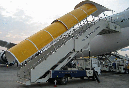
Aircraft steps
This steps provide to passengers a connection from the ground to the airplane. It is often mounted on a light truck or a van, and it can be a extensible or fixed stairs.
Luggage truck
This little truck tows a whole load of packed trailers, with all the passengers’ luggage. Although, the ULD containers are widespread. The Unit Load Device, is a container to load the baggage in, and they fit in the aircraft deck, so the luggage truck tows ULD instead of rusty trailers.

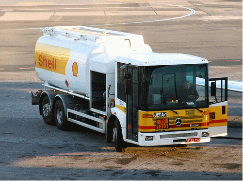
Fuel tanker
That is, a truck full of fuel (usually loaded with Jet A-1, but 100LL for GA is Ok as well) that provides airplanes with kerosene. It’s basically made up of a rear tank, a pump and a hose. Sometimes, they are simply a pump and they get the fuel from a ground hydrant.
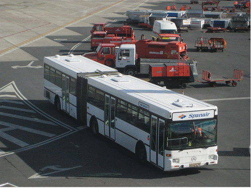
Bendy bus
The bendy bus is comprised of two rigid parts, and it is articulated. They are used as people mover, to transport passengers from the terminal to the remote aircrafts. It’s also possible to use a single bus though.
Fire truck
The fire truck is a special motor vehicle, adapted to fight the fire in case of an emergency landing or a crash. They usually have a water tank and a water gun, able to launch compressed water to parts set on fire up to 200 feet.

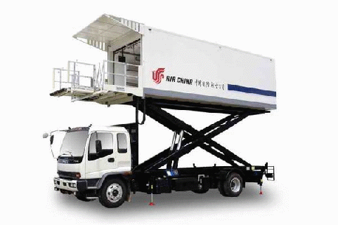
Catering truck
This van serves the airplanes with the most extraordinary and exquisite (¬¬’) airline food, to make passengers feel comfortable when flying. It is basically a big metal box that can be lifted, in order to reach the aircraft height.
Aircraft tow
This tow is just a truck that it frequently lifts the front wheel of the aircraft, and push it back to the correct position to start the taxi to the runway. Sometimes, this little bugs cannot lift the aircraft, so there’s a towing bar that is attached to the front wheel and the truck just tow it back.
MIDTERM TOPICS
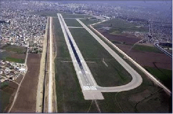
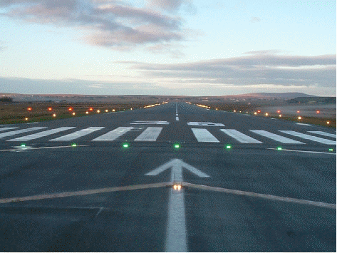
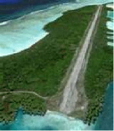
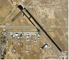
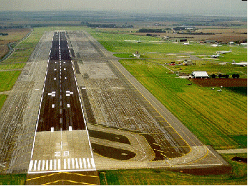
RUNWAY
DEFINTION:
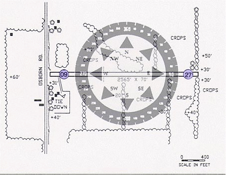
A RUNWAY (RWY) is a strip of land at an airport on which aircraft can take off and land and forms part of the maneuvering area. Runways may be a man-made surface (often asphalt, concrete, or a mixture of both) or a natural surface (grass, dirt, gravel, ice, or salt).
DESIGNING AN AIRPORT RUNWAY
The two more important sizes are he runway length and the width. Depending on the aircraft expected to operate on the airport, you might use larger or shorter distance. There is no specific runway length establish by FAA or ICAO, but could change from 200 meters to infinite (if we could have that region). About the runway width ii is mandatory to be greater than 18 meters up to 150 meters (around the runway) and shoulders up to 15 meters (paved margins at both sides of the runway).
RUNWAY PAVEMENT SURFACE
The choice of material used to construct the runway depends on the use and the local ground conditions. For major airport, where the ground conditions permit, the most satisfactory type of pavement for long-term minimum maintenance is concrete. For pavement designs borings are taken to determine the sub grade condition, and based on the relative bearing capacity of the sub grade, the specification are established.
For pavement designs, borings are taken to determine the subgrade condition, and based on the relative bearing capacity of the subgrade, the specifications are established. For heavy-duty commercial aircraft, the pavement thickness, no matter what the top surface, varies from 10 in (250 mm) to 4 ft (1 m), including subgrade.
Airport pavements have been designed by two methods. The first, Westergaard, is based on the assumption that the pavement is an elastic plate supported on a heavy fluid base with a uniform reaction coefficient known as the K value[disambiguation needed]. Experience has shown that the K values on which the formula was developed are not applicable for newer aircraft with very large footprint pressures.
The second method is called the California bearing ratio and was developed in the late 1940s. It is an extrapolation of the original test results, which are not applicable to modern aircraft pavements or to modern aircraft landing gear. Some designs were made by a mixture of these two design theories.
A more recent method is an analytical system based on the introduction of vehicle response as an important design parameter. Essentially it takes into account all factors, including the traffic conditions, service life, materials used in the construction, and, especially important, the dynamic response of the vehicles using the landing area.
Because airport pavement construction is so expensive, every effort is made to minimize the stresses imparted to the pavement by aircraft. Manufacturers of the larger planes design landing gear so that the weight of the plane is supported on larger and more numerous tires. Attention is also paid to the characteristics of the landing gear itself, so that adverse effects on the pavement are minimized. Sometimes it is possible to reinforce a pavement for higher loading by applying an overlay of asphaltic concrete or portland cement concrete that is bonded to the original slab.
Post-tensioning concrete has been developed for the runway surface. This permits the use of thinner pavements and should result in longer concrete pavement life. Because of the susceptibility of thinner pavements to frost heave, this process is generally applicable only where there is no appreciable frost action.
Pavement surface
Runway pavement surface is prepared and maintained to maximize friction for wheel braking. To minimize hydroplaning following heavy rain, the pavement surface is usually grooved so that the surface water film flows into the grooves and the peaks between grooves will still be in contact with the aircraft tires. To maintain the macrotexturing built into the runway by the grooves, maintenance crews engage in airfield rubber removal or hydrocleaning in order to meet required FAA friction levels.
Surface Type Codes
In aviation charts, the surface type is usually abbreviated to a three-letter code.
The most common hard surface types are Asphalt and Concrete. The most common soft surface types are Grass and Gravel.
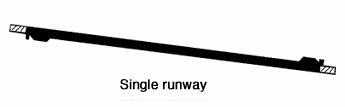
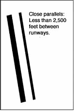
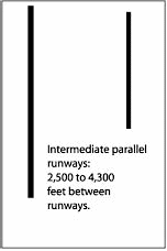
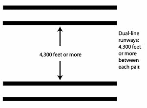
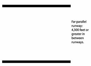
 There
are 4 types of parallel runways. These are named according to how
closely they are placed next to each other. Operations per hour will
vary depending on the total number of runways and the mix of the
aircraft. In IFR conditions for predominantly light aircraft, the
number of operations would range between 64-128 per hour.
There
are 4 types of parallel runways. These are named according to how
closely they are placed next to each other. Operations per hour will
vary depending on the total number of runways and the mix of the
aircraft. In IFR conditions for predominantly light aircraft, the
number of operations would range between 64-128 per hour.
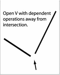
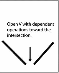
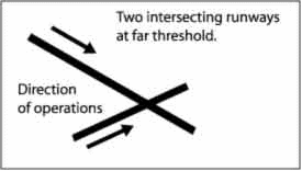
 Two
or more runways that cross each other are classified as intersecting
runway. This type of configuration is used when there are relatively
strong prevailing winds from more than one direction during the
year. When the winds are strong from one direction, operations will
be limited to only one runway. With relatively light winds, both
runways can be used simultaneously. The greatest capacity for
operation is accomplished when the intersection is close to the
take-off end and the landing threshold. There are three subtypes of
intersecting runway configuration namely:
Two
or more runways that cross each other are classified as intersecting
runway. This type of configuration is used when there are relatively
strong prevailing winds from more than one direction during the
year. When the winds are strong from one direction, operations will
be limited to only one runway. With relatively light winds, both
runways can be used simultaneously. The greatest capacity for
operation is accomplished when the intersection is close to the
take-off end and the landing threshold. There are three subtypes of
intersecting runway configuration namely: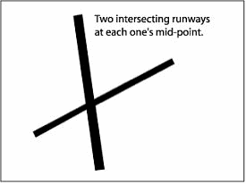

 VISUAL
RUNWAYS
are used at small airstrips and are usually just a strip of grass,
gravel, asphalt or concrete. Although there are usually no markings
on a visual runway, they may have threshold markings, designators,
and centerlines. Additionally, they do not provide an
instrument-based landing procedure; pilots must be able to see the
runway to use it. Also, radio communication may not be available
and pilots must be self-reliant.
VISUAL
RUNWAYS
are used at small airstrips and are usually just a strip of grass,
gravel, asphalt or concrete. Although there are usually no markings
on a visual runway, they may have threshold markings, designators,
and centerlines. Additionally, they do not provide an
instrument-based landing procedure; pilots must be able to see the
runway to use it. Also, radio communication may not be available
and pilots must be self-reliant.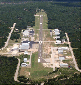 NON-PRECISION
INSTRUMENT RUNWAYS
are often used at small- to medium-size airports. These runways,
depending on the surface, may be marked with threshold markings,
designators, centerlines, and sometimes a 1,000 ft (305 m)
mark (known as an aiming point, sometimes installed at 1,500 ft
(457 m)). They provide horizontal position guidance to planes
on instrument approach via
NON-PRECISION
INSTRUMENT RUNWAYS
are often used at small- to medium-size airports. These runways,
depending on the surface, may be marked with threshold markings,
designators, centerlines, and sometimes a 1,000 ft (305 m)
mark (known as an aiming point, sometimes installed at 1,500 ft
(457 m)). They provide horizontal position guidance to planes
on instrument approach via 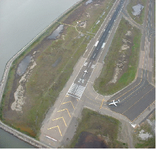 PRECISION
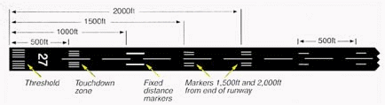
INSTRUMENT RUNWAYS,
which are found at medium- and large-size airports, consist of a
blast pad/stopway (optional, for airports handling jets),
threshold, designator, centerline, aiming point, and 500 ft
(152 m), 1,000 ft (305 m)/1,500 ft (457 m),
2,000 ft (610 m), 2,500 ft (762 m), and
3,000 ft (914 m) touchdown zone marks. Precision runways
provide both horizontal and vertical guidance for instrument
approaches.
PRECISION
INSTRUMENT RUNWAYS,
which are found at medium- and large-size airports, consist of a
blast pad/stopway (optional, for airports handling jets),
threshold, designator, centerline, aiming point, and 500 ft
(152 m), 1,000 ft (305 m)/1,500 ft (457 m),
2,000 ft (610 m), 2,500 ft (762 m), and
3,000 ft (914 m) touchdown zone marks. Precision runways
provide both horizontal and vertical guidance for instrument
approaches.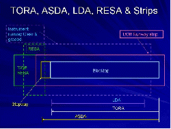


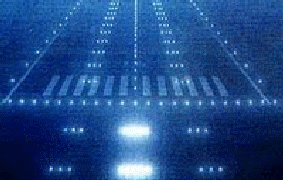
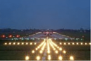
 Runway
lighting is used at airports which allow night landings. Seen from
the air, runway lights form an outline of the runway. A particular
runway may have some or all of the following.
Runway
lighting is used at airports which allow night landings. Seen from
the air, runway lights form an outline of the runway. A particular
runway may have some or all of the following. unidirectional
(facing approach direction) or omnidirectional pair of
synchronized flashing lights installed at the runway threshold,
one on each side.
unidirectional
(facing approach direction) or omnidirectional pair of
synchronized flashing lights installed at the runway threshold,
one on each side.